Light Detection and Ranging (LiDAR) Technology
Goal
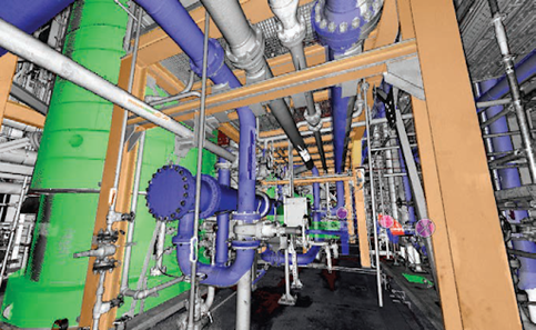
Provide a technical assessment and evaluation of how LiDAR data may be collected and transformed into links directly with plant database information to simplify the use in hazard analysis. LiDAR uses fast rotating distance measurement equipment to construct a 3D model out of points of measurement, called a point cloud. This provides accurate spatial information but nothing else. To be more useful, facilities must label or tag information to specific points in the model. This work looked at ways to use artificial intelligence to assist humans in tagging this data with the main task of the human to verify and complete unknown items. The results would be a model with detailed item information and the location for use in various analysis tools.
Outcome
Researchers demonstrated how LiDAR technology can support hazard analyses. Using an existing plant data model system or FRANX databases from existing plants, this project showed how to simplify the process of linking the data to spatial locations or items in the 3D model developed using LiDAR. The pilot project demonstrated the process of how a LiDAR-developed 3D model was linked to plant data and then exported for direct use in fire probabilistic risk assessment with very little manually linking of data. This pilot demonstrated a process that significantly reduced manual efforts typically needed for similar tasks.
Major accomplishments
Completed the development of LiDAR technology and demonstrated the enhanced capability of an application (using Fire Risk in 3D) from the incorporation of LiDAR into the application process.


